


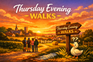
Ditch the Sofa—Join Us for an Evening Stroll!
Summer’s here, and that means it’s time to swap your slippers for walking boots! The Fleckney Walking Club’s Thursday evening walks are a perfect way to stretch your legs, enjoy the fresh air, and pretend you’re training for an epic expedition (when really, it’s just 4 to 6 miles).
🚶♂️ Meet us at the village car park, High Street, Fleckney, by 7 p.m. (///loses.always.huts).
But wait, there’s more!
Early morning walks of 3 to 6 miles take place every weekday (Monday to Friday) at 8:30 a.m.
If you fancy a Sunday walk, we have short (4 to 6 miles) walks every Sunday and medium (6 to 8 miles) adventures every other Sunday.
⏰ We set off at 9:30 a.m. from the same car park.
For these longer jaunts, decent walking boots are a must (flip-flops are a definite no), and a waterproof jacket might save you from looking like a drowned rat if the weather turns. We also suggest bringing snacks—because let’s be honest, everything’s better with a coffee break. These jaunts usually include a pub stop—because hydration is important.
So, come along, stretch your legs, have a laugh, and discover just how nice a walk can be when it ends with a drink! 🍻
The annual cost to join the Fleckney Walking Club is £5.